100 Years
Down the Road
The Jefferson Highway
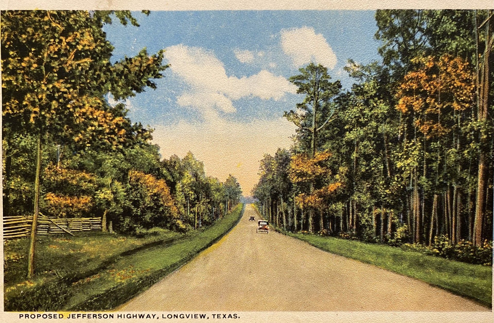
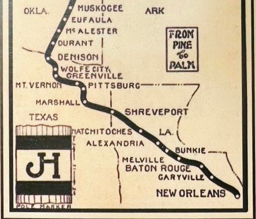
Photo courtesy of Roger Bell - Jefferson Highway Association
By Sharon Harper
The first thing travelers noticed entering Texas from the north wasn’t a welcome sign. It was the Red River.
For generations, the river marked the northern gateway to Texas, carrying steamboats, freight trains and, eventually, automobiles between Oklahoma and the Lone Star State. In 1926, as motorists crossed the Red River Toll Bridge into Denison, they weren’t simply entering Texas. They were continuing south on one of North America’s most notable early automobile routes.
Known as the Jefferson Highway, the route stretched more than 2,300 miles from Winnipeg, Canada, to New Orleans. Nicknamed the Pine to Palm Highway, it connected the pine forests of the north with the palm tree landscapes of the Gulf Coast. The highway was named for Thomas Jefferson, honoring his role in the Louisiana Purchase. The road’s north-south route ran through much of the territory the United States acquired in 1803.
The Jefferson Highway Association organized in 1915, and communities spent the next decade establishing, improving and promoting the route. By 1926, those efforts had reached an important milestone. On February 4 of that year, Winnipeg Mayor Ralph Webb arrived in New Orleans, where he was welcomed by New Orleans Mayor Arthur O’Keefe in a celebration of the completed highway connecting the two cities.
A century later, that milestone is being celebrated again. The anniversary is worth remembering not simply because of the road itself, but because of what it meant to the communities it served.
Long before Interstate 30 and U.S. Highway 75 carried travelers swiftly across Northeast Texas, the Jefferson Highway invited them to slow down. Every town along the route offered a reason to stop. It could be a meal, a night’s rest, a courthouse square or simply a conversation with someone who called that community home. For East Texas, the highway became a road to opportunity.
A Road Built by Communities
The Jefferson Highway wasn’t built by the federal government. It grew from an idea shared by business leaders, civic organizations and communities that believed better roads would shape their future.
In the early years of the automobile, dependable highways were still a luxury. Travelers relied on local directions, railroad maps and guidebooks. Roads changed from pavement to gravel to dirt with little warning, and a heavy rain could bring a journey to a halt.
Organized in 1915, the Jefferson Highway Association promoted a continuous international route linking Canada with the Gulf of Mexico. Rather than constructing an entirely new highway, the association connected existing roads, encouraged improvements and worked with towns eager to become part of the route.
Communities quickly recognized what was at stake. A place on the Jefferson Highway meant visitors, an increase in business and a place on one of the country’s earliest great road trips.
Bonham’s enthusiasm for the highway was unmistakable. In the January 1918 Jefferson Highway Declaration, a representative speaking on behalf of Bonham and Fannin County thanked the association for its consideration and offered a memorable declaration: “May Bonham live a thousand years less a day, for Bonham would not care to be on the map should the Jefferson Highway go some other way.”
Following the “JH”
Modern travelers depend on GPS. Motorists in the 1920s looked for something much simpler: white and blue “JH” emblems painted by volunteers on telephone poles, bridges and buildings along the route.
Imagine leaving Denison on a spring morning in 1926, the road stretching through open farmland toward Bonham. Every few miles, another painted marker appeared to assure motorists they were headed in the right direction. There were no interstate exits or overhead signs, just a ribbon of road connecting one community to the next.
The journey required patience. Flat tires were common. Roads turned dusty in summer and muddy after a rain. Gas stations weren’t found at every intersection, so travelers planned their days around the towns ahead. That dependence on the next community became part of the Jefferson Highway experience — and East Texas was ready to welcome them.
Towns Along the Way
In Denison, motorists entered Texas at a city already shaped by transportation. Railroads had helped build the community, and automobiles were opening another chapter. Its position near the Red River made Denison a natural gateway to the Texas portion of the Jefferson Highway.
From there, travelers made their way toward Bonham, where the enthusiasm for the highway reflected just how important automobile traffic had become. Reminders of that early era are still found there, including the 1918 Magnolia Oil Co.
station and the 1921 Powder Creek Bridge. The courthouse at the center of town was another reassuring landmark for travelers making their way across unfamiliar country.
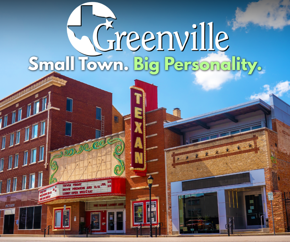
The road eventually carried motorists to Greenville, already one of North Texas’ important commercial centers. Railroads and cotton had helped establish the city, but automobiles brought travelers who arrived on their own schedules. They could shop downtown, stop for dinner, spend the night and leave when they pleased. Hotels welcomed motorists, service stations multiplied and merchants discovered customers who might have come from across Texas or far beyond it.
The Jefferson Highway didn’t create Greenville’s success. It introduced Greenville to more of the world.
From Greenville, the journey continued east through Sulphur Springs, where the courthouse square and surrounding businesses offered the kinds of services road travelers depended upon. The highway gave motorists a reason to stop rather than simply pass through, a pattern that repeated itself from one community to the next.
Beyond Sulphur Springs came Mount Vernon and Mount Pleasant, two communities that helped carry travelers farther into Northeast Texas. With each mile, the landscape began to change. The broad prairies gradually gave way to more heavily wooded countryside, and the pine forests associated with the highway’s Pine to Palm nickname became increasingly evident.
By the time motorists reached Pittsburg, they had settled into the rhythm of the road. This wasn’t a highway built for speed. It encouraged people to stop, stretch their legs, visit a town square and strike up conversations with people they had never met. From Pittsburg, the route continued toward Gilmer, another important link in the journey south and east through the region.
That may be one of Jefferson Highway’s greatest legacies. Long before “road trip” became part of the American vocabulary, he highway encouraged travelers to experience the country one community at a time.
For towns that once relied heavily on railroad traffic, the automobile opened new possibilities. Visitors were no longer limited by train schedules. They could linger, take another road or decide to spend the night simply because they liked what they found.
The highway itself was evolving, too. The Jefferson Highway was not a single strip of pavement laid down at one moment in time. Roads were improved, connections changed and portions of the route shifted as better roadways became available. That evolving route brought Jefferson Highway travelers through Gladewater, which would soon find itself at the center of one of the biggest economic transformations in Texas history. Then came oil.
The East Texas Oil Boom changed Gladewater almost overnight as workers, investors and visitors poured into the region. The Jefferson Highway didn’t create the boom, but the road system that had been developing through East Texas helped connect communities like Gladewater to a nation increasingly traveling by automobile.
Today, Gladewater is known as the Antique Capital of East Texas, where historic storefronts continue to welcome people looking for something they can’t find just anywhere. The reasons for stopping have changed. The tradition of welcoming travelers has not.
From Gladewater, the journey continued toward Longview, a city where transportation had long played an important role in growth and commerce. Railroads connected Longview with distant markets, but the automobile promised a different kind of traveler — one who could arrive on his own schedule, stop along the way and explore communities beyond the railroad depot.
A 1921 postcard showing the proposed Jefferson Highway through Longview captures that moment particularly well. Long before motorists could follow interstate signs or pull up directions on a phone, communities were promoting their place on the developing highway and imagining what increased automobile travel might mean for local businesses and residents. More than a century later, the postcard is more than a souvenir. It offers a glimpse of the anticipation surrounding a new era of travel and a highway that was still taking shape.
From Longview, motorists continued toward Marshall, a city that understood the importance of transportation perhaps better than most. Long before automobiles, railroads helped establish Marshall as one of East Texas’ leading commercial and cultural centers. The Jefferson Highway added another layer to that history.
Motorists drove beneath mature trees, past handsome neighborhoods and into a downtown shaped by decades of commerce and growth. Hotels, restaurants and merchants welcomed a new generation of travelers arriving not by train, but behind the wheel. For motorists continuing south and east, Marshall became another important stop on a journey that would eventually carry them into Louisiana and toward New Orleans.
The Road Is Still There
A century later, the original blue-and-white “JH” markers no longer guide motorists along most of the route, but efforts are underway to make the historic highway more visible again. Portions of the historic route can still be traveled, while bridges, early automobile-era buildings and downtown business districts remain as reminders of the highway’s past.
The road is still there, and so are the communities that believed in it.
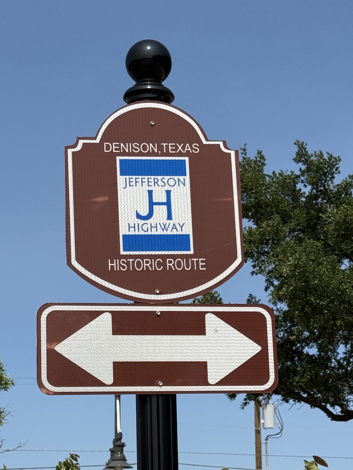
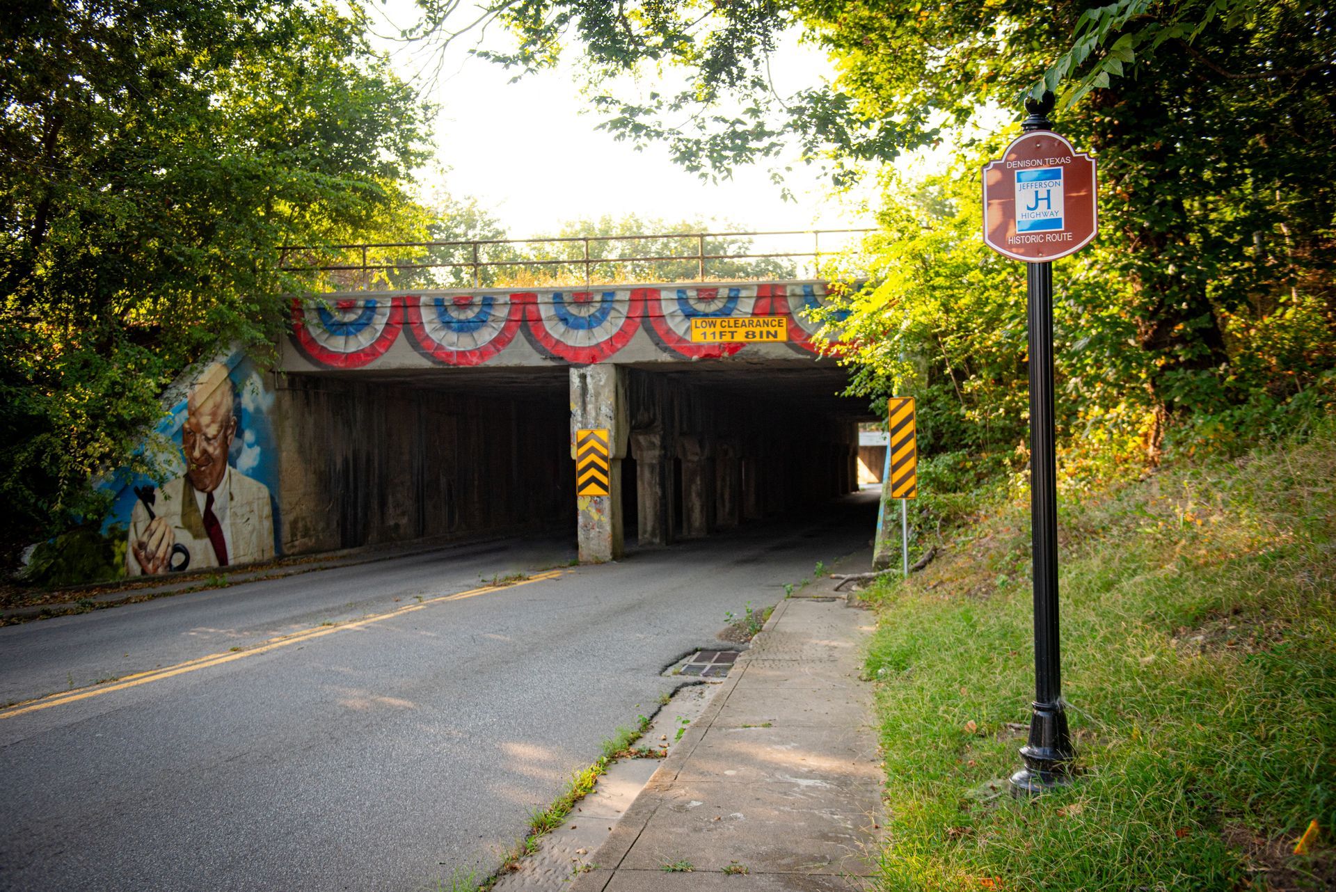
So, too, is the Jefferson Highway Association. Revived in 2011, today’s association works to identify, preserve and promote the historic highway while encouraging a new generation of travelers to discover the communities along its route. Denison and Bonham have installed Jefferson Highway signs in their communities, and the association hopes more towns along the Texas route will follow, creating a more visible trail for travelers interested in retracing the historic highway.
This fall, that work takes on special significance as association members and highway enthusiasts gather in Joplin, Missouri, September 19-22 for the Crossroads of America Centennial Celebration. The event coincides with the centennial of Route 66 and includes activities with the Route 66 Association of Missouri Fall Motor Tour, bringing together travelers with an interest in two historic highways that helped shape early automobile travel. The celebration is also an extension of the association’s continuing mission of preserving the Jefferson Highway’s history while encouraging travelers to get back on the old road.
There is a temptation to remember the Jefferson Highway simply as an important transportation project, but it deserves more than that. The highway represents a time when communities looked beyond their city limits and worked toward a common goal. Local leaders understood that the success of one town strengthened the entire route.
The Upper East Side of Texas continues to offer what made the route worth traveling in the first place: friendly people, historic downtowns, and interesting stories waiting around the next bend.